Landnotes lets you specify a date on a map and displays events that occurred at that time.
Looking up a place name on Wikipedia can help you learn about events that occurred there in the past and famous people who have ties to the area, which can be essential knowledge for understanding what kind of place it is. However, if you want to learn about historical events over a wider area, you have to look up each place name individually, which is not very convenient. 'Landnotes' is a service that allows you to specify a date on OpenStreetMap and displays on the map all events that occurred on the specified date that are registered on Wikipedia.
Landnotes
Zulko/landnotes: A map with millions of events from Wikipedia
https://github.com/Zulko/landnotes
First, click on the ' try it out! ' link in the GitHub README. This will take you to the Landnotes site, which displays almost all of Europe. Because the URL parameter 'paneTab=about' is specified, a pane called 'Welcome to Landnote' is displayed on the left side of the screen. At the time of writing, the site states, '6.5 million events extracted from 400,000 articles using Google Gemini are registered.' The URL parameter 'date=1949--2' also filters the results by ' February 1949. '
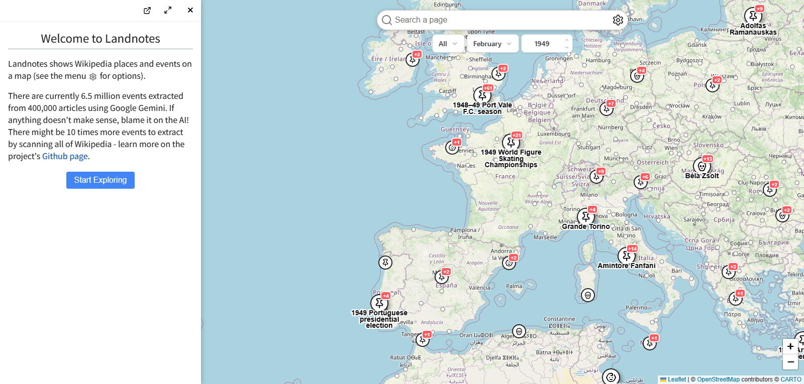
After a quick look around, I noticed several different types of icons displayed on the map.
Pinned icon : General events
Baby Icons : Celebrity Births
Skull icon : Death of a famous person
- Bag icon : Visit of a celebrity
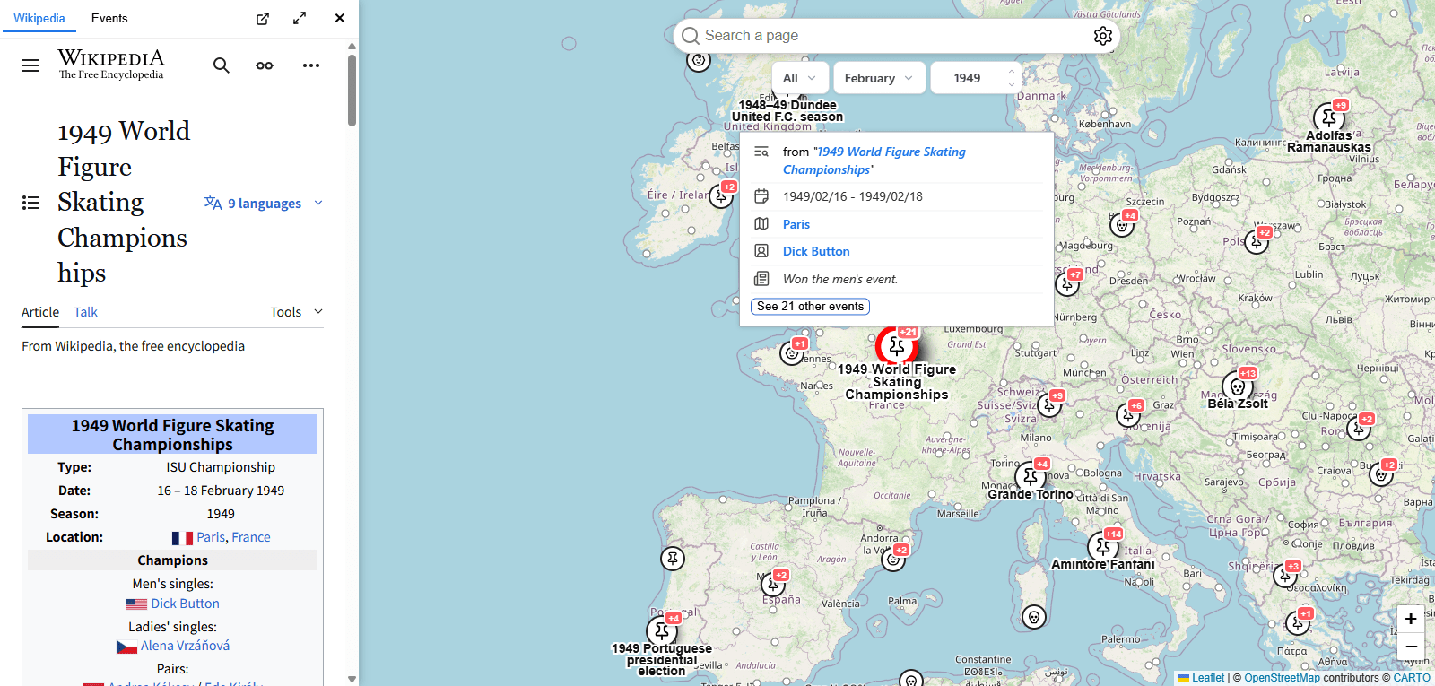
I hovered my mouse cursor over a 'Pin' icon in what appears to be Paris, a northern French city. A pop-up appeared saying 'from '1949 World Figure Skating Championships'.' There was a link, so I clicked it. The English Wikipedia entry for '
Next, I clicked on the 'baby' icon for Brittany, a region in western France. A pop-up revealed that it was the birthplace of cyclist
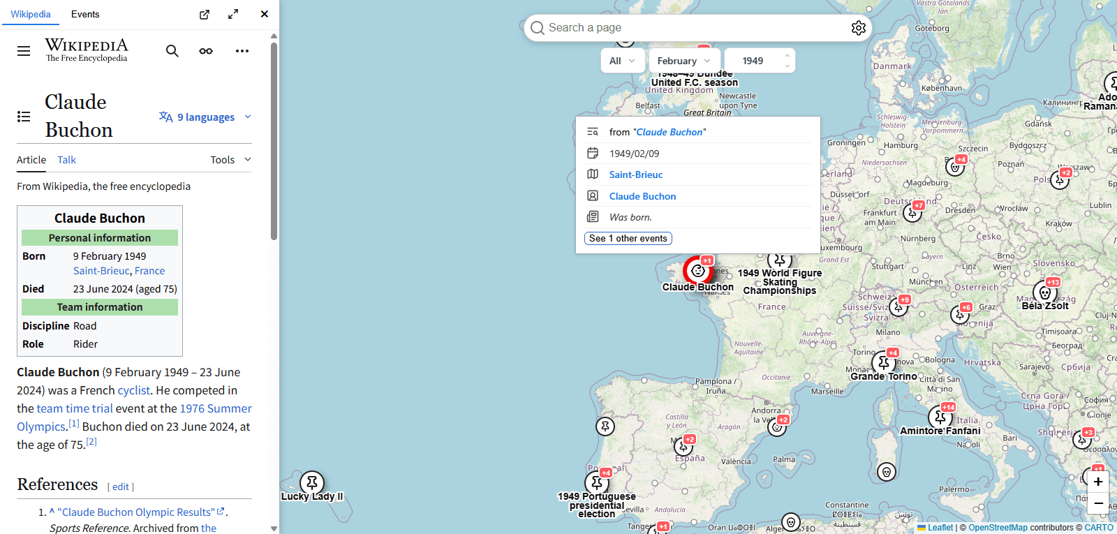
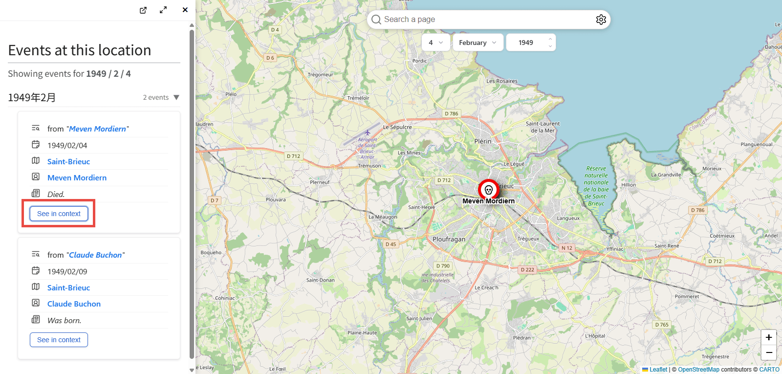
One thing that bothered me was the '+1' notation in the top right corner of the icon. If you look closely at the popup, you'll see that there's also a 'See 1 other events' button.
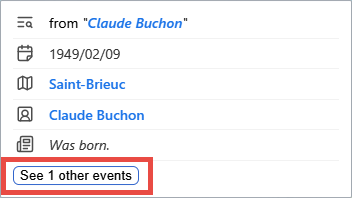
Clicking the button switched the left pane to 'Events at this location,' displaying information about Meven Mordiern in addition to Claude Buchon. There was a 'See in context' button, which when clicked, changed the map, displaying a skull icon in the center. Checking the Wikipedia topic displayed , it seems that Meven Mordiern likely died here on February 4, 1949, although it wasn't explicitly stated.
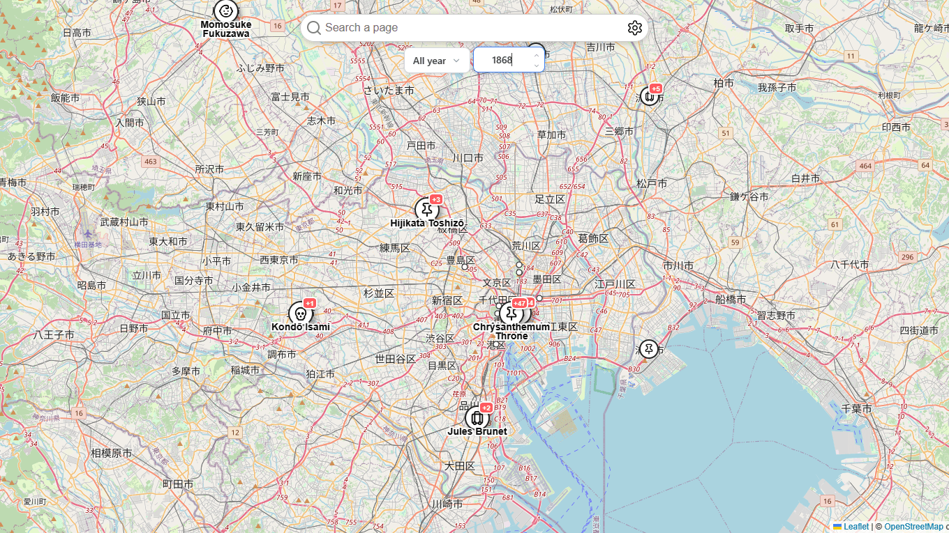
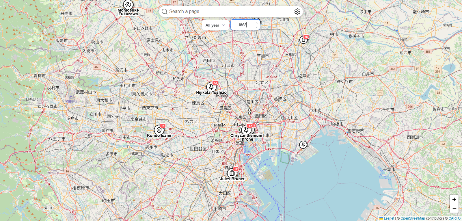
Next, let's narrow the time period. I moved the map to the Tokyo metropolitan area of Japan and selected 1868. Selecting 'All' for the day will display all days of a specific month and year, while selecting 'All Year' for the month will display the entire year. This leads to names like
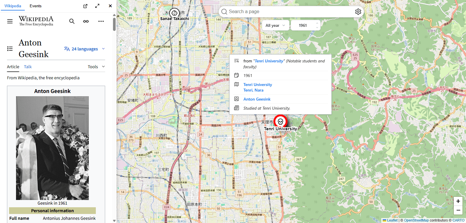
If you move the map to the Nara Basin and select 1961, you'll see an icon indicating that this is

Clicking on the 'Tenri University' icon reveals that the university is apparently associated with
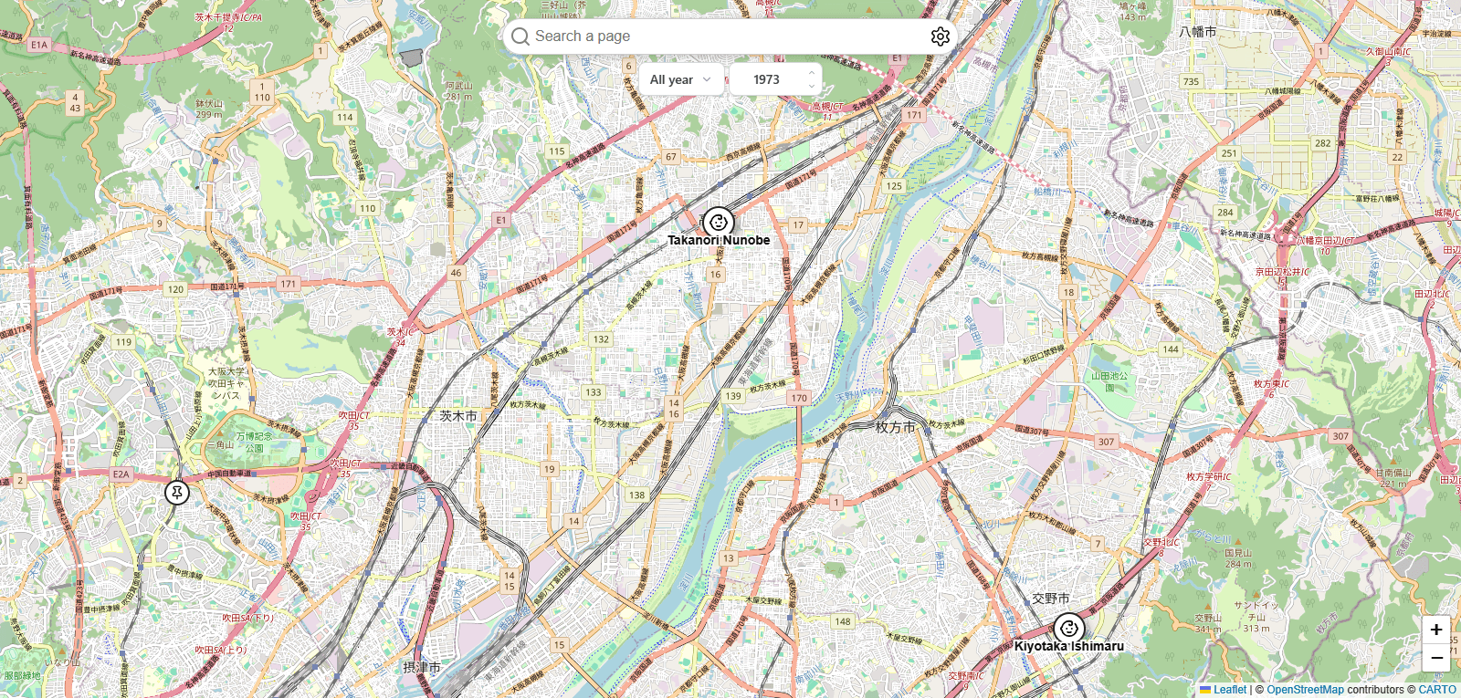
Finally, let's look at 1973 in northern Osaka. It is shown to be the birthplace of former soccer players such as
Although Landnotes relies on data from the English Wikipedia, I was able to discover some surprising connections between places and events. If you're interested, why not visit Landnotes and think about the events and people who have occurred in your local area in the past?
Related Posts:


in AI, Web Service, Review, Posted by log1c_sh