A passing satellite captures previously unknown details of the massive tsunami

On July 30, 2025, a massive earthquake measuring 8.8 on the Richter scale struck
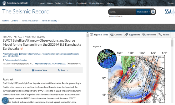
SWOT Satellite Altimetry Observations and Source Model for the Tsunami from the 2025 M 8.8 Kamchatka Earthquake | The Seismic Record | GeoScienceWorld
https://pubs.geoscienceworld.org/ssa/tsr/article/5/4/341/718867/SWOT-Satellite-Altimetry-Observations-and-Source
Satellite captures the first detailed look at a massive tsunami - Earth.com
https://www.earth.com/news/satellite-captures-the-first-detailed-look-at-a-giant-tsunami/
In 2022, NASA and the French National Center for Space Studies jointly launched an Earth observation satellite called SWOT (Surface Water and Ocean Topography) . SWOT is a satellite designed to investigate the altitude of the Earth's surface waters. It is capable of measuring sea and surface water levels by transmitting radar pulses to the Earth's surface and triangulating the reflected signals using two antennas simultaneously.
Then, in 2025, when a massive earthquake occurred near the Kamchatka Peninsula and triggered a tsunami across the Pacific, SWOT happened to be passing overhead, allowing it to capture a detailed image of the massive tsunami. Until now, the Deep-ocean Assessment and Reporting of Tsunamis (DART) , a buoy-type system that records changes in seafloor temperature and pressure, was the best monitoring device for the open ocean. However, while DART is highly sensitive, there is a limit to the number of installations, and it was limited in that it could only provide time-series data from a single location.
In contrast, SWOT measures a wide area of sea surface height about 120 km wide in a single pass, allowing scientists to capture the changing shape of the tsunami both spatially and over time. 'We think of SWOT data as like a new pair of glasses,' said Ángel Ruiz-Angl , a physical oceanographer at the University of Iceland and lead author of the paper. 'Previously, DART could only observe tsunamis at specific points across the vast ocean. Other satellites have been around for a while, but even in the best case scenario, they could only capture a thin line across the tsunami. With SWOT, we can capture an area up to about 120 km wide, providing unprecedented high-resolution ocean surface data.'
Conventional thinking has been that large tsunamis that spread across an entire
But instead of a single, orderly wave crest moving across the ocean basin, the waveform images captured by SWOT showed a complex web of energy scattered and dispersed over hundreds of kilometers—a detail rarely captured by conventional instruments.
The image below shows the sea level elevation based on SWOT observations, which suggests that the tsunami is dispersed.
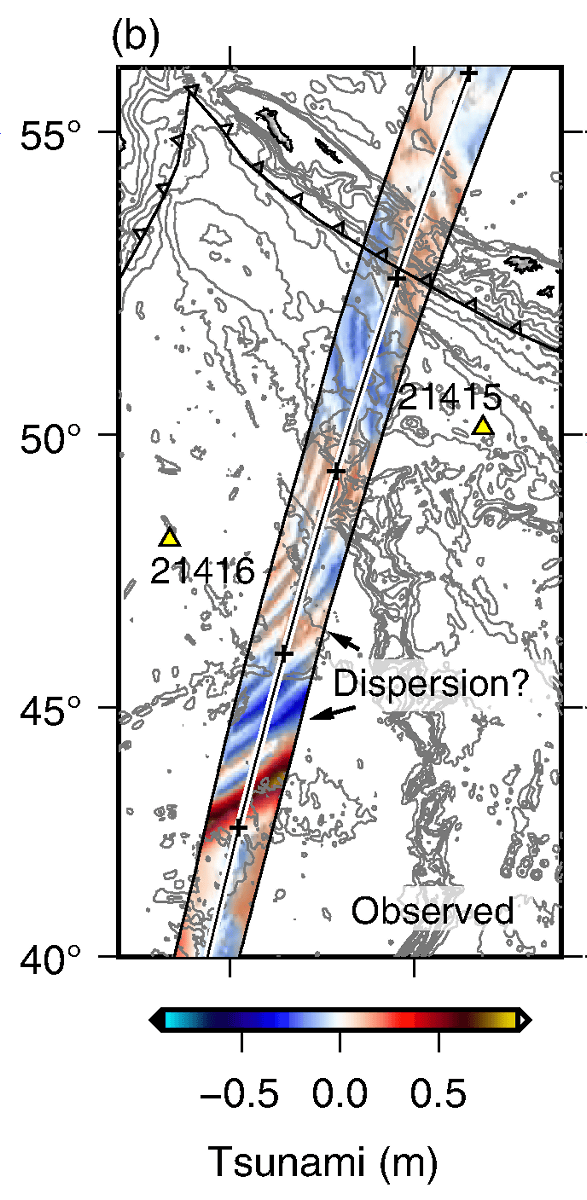
When the research team ran a numerical model incorporating the dispersive effects of the tsunami, they reported that the simulated wave field matched the pattern observed by SWOT much better than when run assuming a 'non-dispersive tsunami.' This suggests that the tsunami is not non-dispersive as previously thought, but is actually dispersive, with the wave's energy being repackaged as it approaches land.
'The main impact of this observation for tsunami modellers is that something is missing from the models they've been running so far,' said Lewis-Angle. 'This extra variability could indicate that the main wave may be modulated by trailing waves as it approaches the coast. We need to quantify this excess dispersive energy and assess whether it has effects that we haven't considered before.'
Related Posts:


in Science, Posted by log1h_ik