A new city shape conceived instead of building a wall at the border
Mr. Donald Trump insists on building a wall at the border between Mexico and the United States for the purpose of preventing invasion of illegal immigrants when he becomes the president, while Mr. Hilary Clinton claims to bridge I will. Meanwhile, Fernando Romero, a Mexican architect who holds the idea that the border is "a symbol of the boundary" due to the evolution of technology "is no longer a symbol of the boundary" About the Mexican border, I draw a vision of a new future city.
Fernando Romero Designs a Binational Border City - CityLab
http://www.citylab.com/design/2016/09/instead-of-a-wall-build-a-binational-city-us-mexico-border-trump/499634/
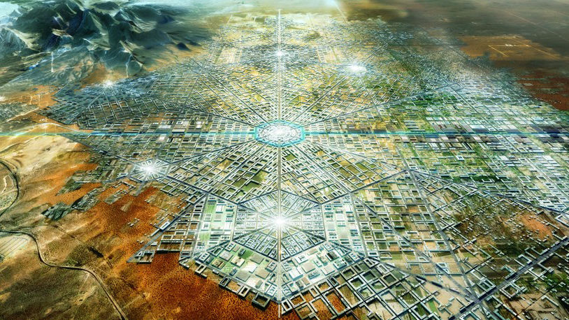
This is the completion drawing of Mr. Romero's future city. The city spreads radially around the hub in the middle and there is something like an economic special zone at the intersection of the line and the line.
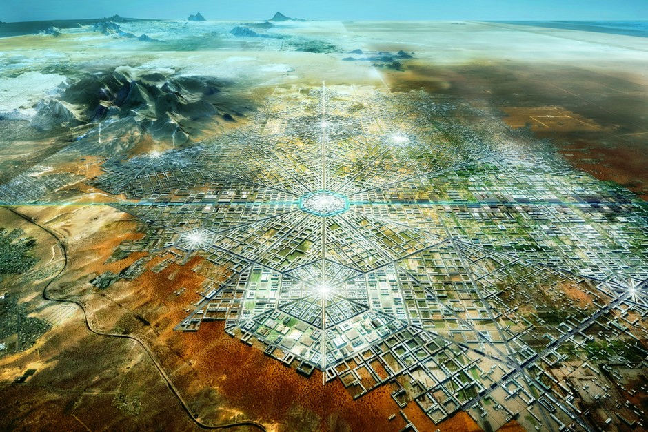
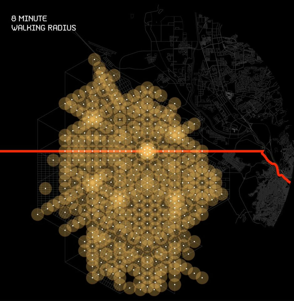
View from the sky. The orange line running in the middle is the border.
The idea of this future city got the concept from the history of the city. In the vicinity of the border between the United States and Mexico, like Hong Kong and Andorra, two cultures collide and mix, creating another unique atmosphere.
This town, which can also be called a 'border city', includes the area from New Mexico and Texas states in America to the Chihuahua state of Mexico. Just like in the current state of El Paso in the United States and adjacent to the state of Ciudad Juarez in Mexico, although there is a common part economically, restrictions due to different currencies, movement, labor etc. There is no restriction.
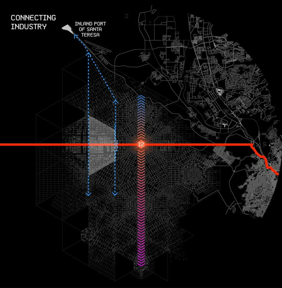
There are several special economic zones in multipolarized border cities, and it is possible for people, materials and services to freely visit and go in towns. The border clearance procedure gate is located in Santa Teresa, New Mexico, USA, but the center of the border city is set up at Santa Teresa and the interstate highway 10 crossing the US is the center of the border city and the United States It connects the west coast and the east coast of. In addition, roads and railroads connect each special economic zone in a border city with important industrial sites.
This border city is not just a concept. Mr. Romero plans to build such a border city on his private property in the coming decades. Mr. Parag Kanna, a global strategist, predicts that the central urban area that has been closely connected across the boundary will have great power in the future global stage. From this point of view, Mr. Romero's vision is It can be said that it is reasonable as a future city.
Details of the structure of the city below. Represented by the red line is the border with the blue line connecting the three economic cities of Santa Teresa and San Jeronimo and San Jose in the south, which are on the north side of the border. The blue line shows the roadway, and each city / community is connected by a road.
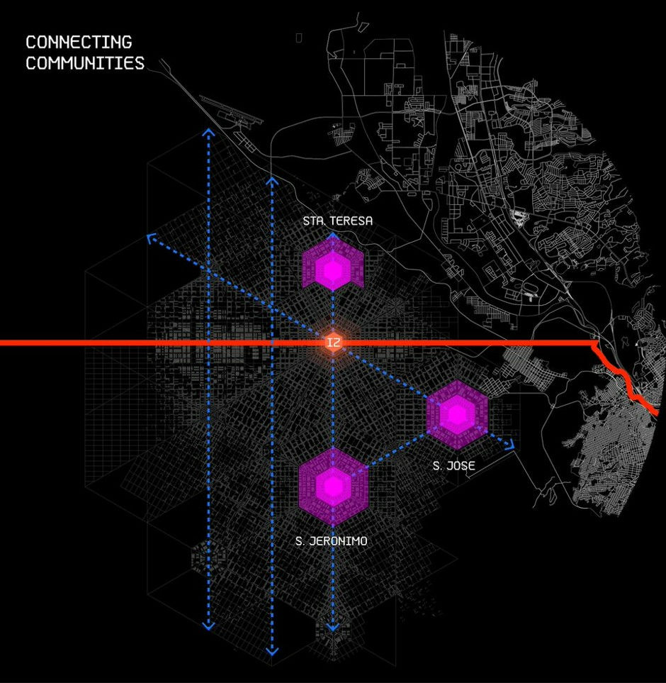
Inland port Santa Teresa connects the border city with the outside world, creating a supply and demand chain.
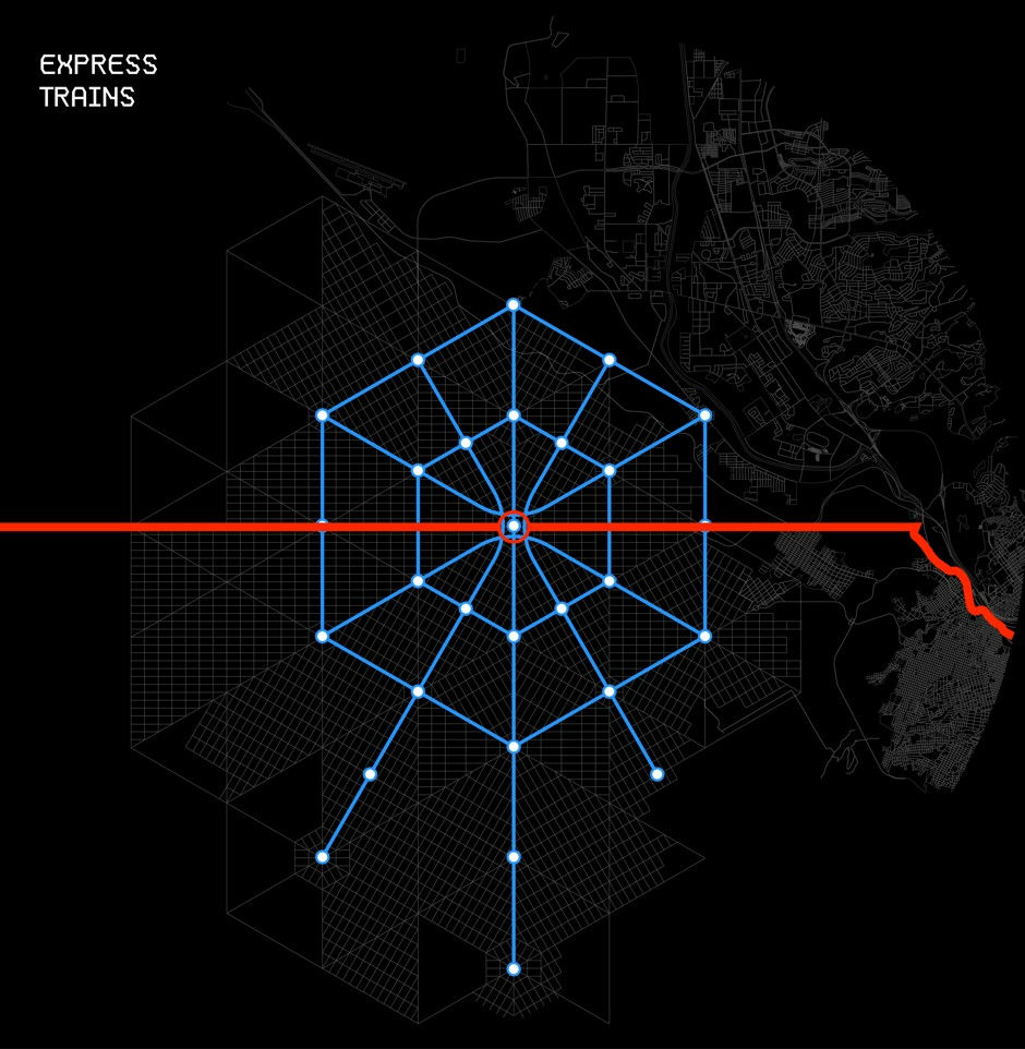
It seems that the track of the train is spreading like a spider web.
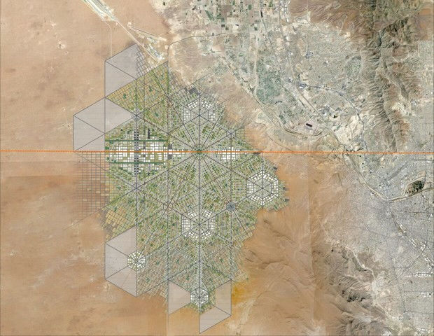
There are several economic zones in cities spreading like geometric patterns. The color of the map below shows population density and you can see that people are densely populated around special economic zones.

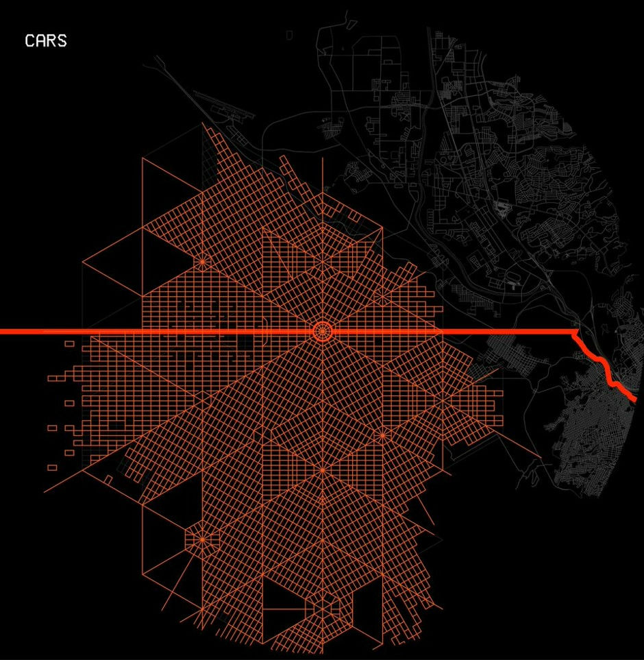
The road is like this.
The bus runs on the following lines.

The bicycle road spreads further in a mesh pattern.
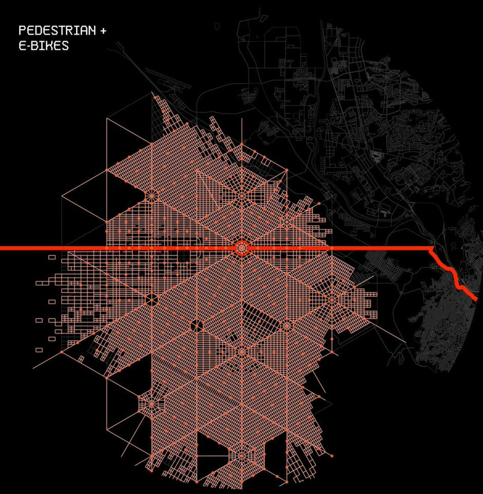
Moreover, it is said that it is designed to be suitable for movement on foot, as well as ease of movement in automobiles, bicycles and buses.
Related Posts:

in Note, Posted by darkhorse_log